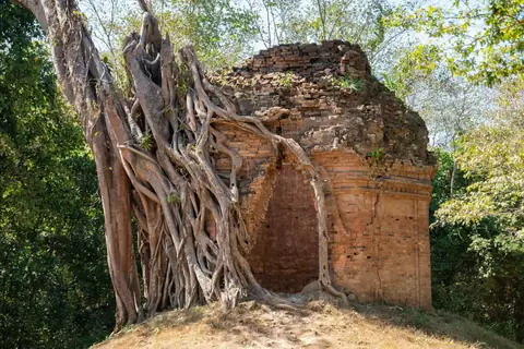
Description
The provincial tourism directory lists Tnous Taprum as a natural outing near the boundary of Srueng commune in Prasat Sambor and Tipo commune in Santuk. Other Khmer reporting uses the spelling.
Rocky watercourses and a forest setting are the focus of the visit. The name refers to this local landscape, not Ta Prohm temple at Angkor; current access and any community service must be arranged separately.
Site reference ↗How to Get There
Take a Phnom Penh–Siem Reap bus or minivan and get off in Kampong Thom, or drive along National Road 6. Continue to countryside destinations by car or local road transport.
For Thnos Ta Prohm Riverside Site, continue toward Srueng–Tipo commune border area, Prasat Sambor–Santuk. A car or motorbike covers the local road section; use the established approach for the final walk and keep a return vehicle for a countryside outing.
Road and transport context ↗Admission
Outdoor public areas, private premises and paid activities have different entry arrangements. A reliable single admission tariff for the whole destination is not published in the reviewed sources.
Things to Do
Enjoy the stream and rock scenery from a suitable permitted bank. Ask a host which paths and stopping areas are open.
Take picnic or a longer local outing only after confirming access, weather and the return journey. Do not assume a safe bathing area or camping permission.
Site reference ↗What to Eat
Try freshwater fish, rice dishes and seasonal fruit in town. Pack lunch and water for a longer archaeological or wetland excursion.
Where to Stay
Stay around Kampong Thom town and the Stung Sen riverfront for restaurants and transport. A community forest or lake overnight is a separate programme.
Best Time to Visit
Morning or late afternoon is comfortable for outdoor city walking. Plan evening entertainment around the dated programme rather than a general daytime sightseeing schedule.
Before You Go
Respect working irrigation and fishing areas. Keep clear of strong flows and restricted structures, supervise children near water and take litter away.
Videos
No verified video has been added for this place yet.
Location map
Site location: Thnos Ta Prohm Riverside Site
Shows the published site location; follow the signed visitor approach.
Location reference ↗Srueng–Tipo commune border area, Prasat Sambor–Santuk, Kampong Thom Province, Cambodia
Guide reviewed 25 October 2026. Prices and access can change.