Description
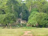
Phnom Bak is one of the hills described in local tourism references together with nearby Phnom Chanhcheang. The area lies west of Serei Saophoan along the National Road 5 corridor.
The Cambodia Association of Travel Agents identifies Wat Phnom Bak, also called Wat Kiri Vong Ksem Ksan, in the Tuek Thla area. Its religious setting and hillside landscape make it a cultural stop as well as a place to enjoy views when access permits.
Site reference ↗How to Get There
Travel by bus, minivan or car to Serei Saophoan on the National Road 5 corridor. Provincial heritage and reservoir stops need a separate road journey from town.
Continue toward Tuek Thla area, Serei Saophoan for Phnom Bak. The road journey reaches the local approach or hill base; climbing, cave and mountain sections continue on foot. A driver for the outward journey does not replace the return transport.
Road and transport context ↗Admission
A hill walk, a religious site, parking and a guided trek may have separate charges. A reliable current tariff for this destination is not published in the reviewed sources.
Things to Do
Visit permitted pagoda grounds quietly and look for an accessible viewpoint. Ask which hillside paths are open before continuing beyond the main worship area.
Combine the stop with nearby Phnom Chanhcheang if a local driver confirms the separate approach. Both hills deserve their own location check rather than being treated as a single entrance.
Site reference ↗What to Eat
Freshwater fish, rice and noodle dishes are practical town meals. Carry water and a packed lunch for a longer temple or birdwatching outing.
Where to Stay
Serei Saophoan is the central town base. Banteay Chhmar community accommodation is better suited to an overnight focused on the temple; Poipet is a separate border-city stay.
Best Time to Visit
Start early for cooler walking and clearer planning around the return. November to February is generally more comfortable for an exposed climb; wet-season trails and cave floors can be slippery.
Before You Go
Dress respectfully, keep voices low near worship and ask before photographing people. Steps and rocky surfaces may be uneven. Do not enter caves or climb steep rock faces without a permitted, locally advised route.
Videos
No verified video has been added for this place yet.
Location map
Site location: Phnom Bak
Shows the published site location; follow the signed visitor approach.
Location reference ↗Tuek Thla area, Serei Saophoan, Banteay Meanchey Province, Cambodia
Guide reviewed 25 October 2026. Prices and access can change.