Description
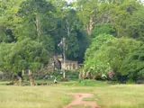
Phnom Chanhcheang appears in tourism references under spellings including Phnom Chenh Chang and Phnom Chenh Chiang. It is described as a separate hill close to Phnom Bak on the western side of Serei Saophoan.
The paired hills are known for steep, wall-like rock faces and a landscape associated with stone carving. This guide concerns that Serei Saophoan hill, not every other Cambodian locality whose name is transliterated as Chanhcheang or Chungcheang.
Site reference ↗How to Get There
Travel by bus, minivan or car to Serei Saophoan on the National Road 5 corridor. Provincial heritage and reservoir stops need a separate road journey from town.
Continue toward National Road 5 corridor west of Serei Saophoan for Phnom Chanhcheang. The road journey reaches the local approach or hill base; climbing, cave and mountain sections continue on foot. A driver for the outward journey does not replace the return transport.
Road and transport context ↗Admission
A hill walk, a religious site, parking and a guided trek may have separate charges. A reliable current tariff for this destination is not published in the reviewed sources.
Things to Do
Observe the rock faces from a suitable ground-level area and photograph the hill landscape without climbing. Ask locally whether there is an open walking route appropriate for your group.
If stone carvers or sellers are working nearby, ask before photographing them and agree on a price before making a purchase. Do not assume workshops are open on every visit.
Site reference ↗What to Eat
Freshwater fish, rice and noodle dishes are practical town meals. Carry water and a packed lunch for a longer temple or birdwatching outing.
Where to Stay
Serei Saophoan is the central town base. Banteay Chhmar community accommodation is better suited to an overnight focused on the temple; Poipet is a separate border-city stay.
Best Time to Visit
Start early for cooler walking and clearer planning around the return. November to February is generally more comfortable for an exposed climb; wet-season trails and cave floors can be slippery.
Before You Go
Keep clear of steep drops, quarrying or working areas and follow local instructions. Phnom Bak and Phnom Chanhcheang are nearby but distinct hills; verify which approach your driver is using.
Videos
No verified video has been added for this place yet.
Location map
Site location: Phnom Chanhcheang
Shows the published site location; follow the signed visitor approach.
Location reference ↗National Road 5 corridor west of Serei Saophoan, Banteay Meanchey Province, Cambodia
Guide reviewed 25 October 2026. Prices and access can change.